In our series “Maps and mappers of the 2016 calendar” we will present throughout 2016 the mapmakers who submitted their creations for inclusion in the 2016 GeoHipster calendar.
***
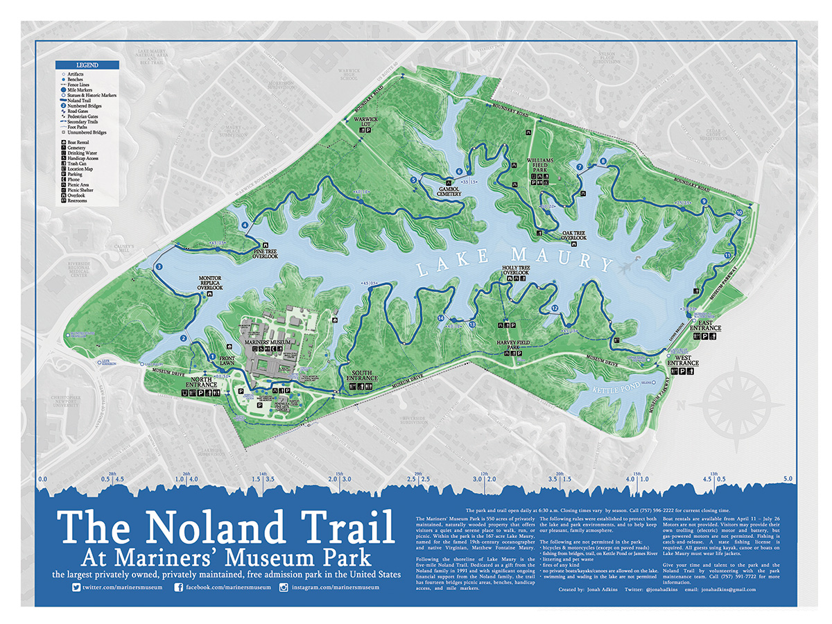
Jonah Adkins
Q: Tell us about yourself.
A: I’m a cartographer from Newport News, Virginia and have been working in GIS since 1999. I enjoy tinkering with mapping tools, co-organizing @maptimehrva, and paid mapping. I‘m most interested in map design, openstreetmap, and civic hacking.
Q: Tell us the story behind your map (what inspired you to make it, what did you learn while making it, or any other aspects of the map or its creation you would like people to know).
A: The Noland Trail is 5-mile escape from reality located at Mariners’ Museum Park in Newport News, Virginia. I’ve probably ran a gajillion miles out there over the last several years, and wanted to create a great map of one of my favorite spots. I started with some pen & paper field mapping, upgraded to some data collection with the Fulcrum app, and made the first version back in 2013. This second version was an exercise in simplifying and refining the first map, it required minimal data updates and a lot more cartographic heart-burn.
Q: Tell us about the tools, data, etc., you used to make the map.
A: The second edition Noland Trail map was made with a combination of QGIS and Photoshop. I threw a ton of information on the first one, probably too much, and it had many ‘GIS-y’ type elements that were lost on the casual map viewer. With this second edition, I wanted to strip away the bulkiness of the original, maintain a high level of detail, and improve the original design. Since the data remained unchanged, with exception of few items, I was able to dedicate the majority of my time on design elements. I’ve also created some related projects like Open-Noland-Trail, an open data site for the trail, and Noland-Trail-GL , a Mapbox GL version of the map built in Mapbox Studio.